
On October 10th, the inaugural meeting of the first Academic Committee of the Institute of Space Remote Sensing and Marine Mapping, Harbin Institute of Technology (Weihai), was held. The meeting invited 13 renowned experts, including Academician Li Deren (winner of the State Supreme Science and Technology Award), Academician Wang Jiayao, and Academician Wang Qiao, to conduct in-depth discussions on cutting-edge areas such as satellite altimetry, satellite gravity, marine remote sensing, and underwater navigation, jointly outlining a new blueprint for the institute's development.
Tan Yiqiu, Assistant President of Harbin Institute of Technology and President of Weihai Campus, delivered a speech and presented appointment letters to the Director, Deputy Directors, members, and Honorary Deans of the Academic Committee. The inaugural meeting was chaired by Vice President Zhang Wencong. Academician Li Deren, Director of the Academic Committee, presided over the first meeting of the Academic Committee. The members engaged in in-depth discussions on the institute's development direction, key project breakthroughs, science and technology award applications, experimental platform construction, and talent team cultivation, offering numerous guiding suggestions.
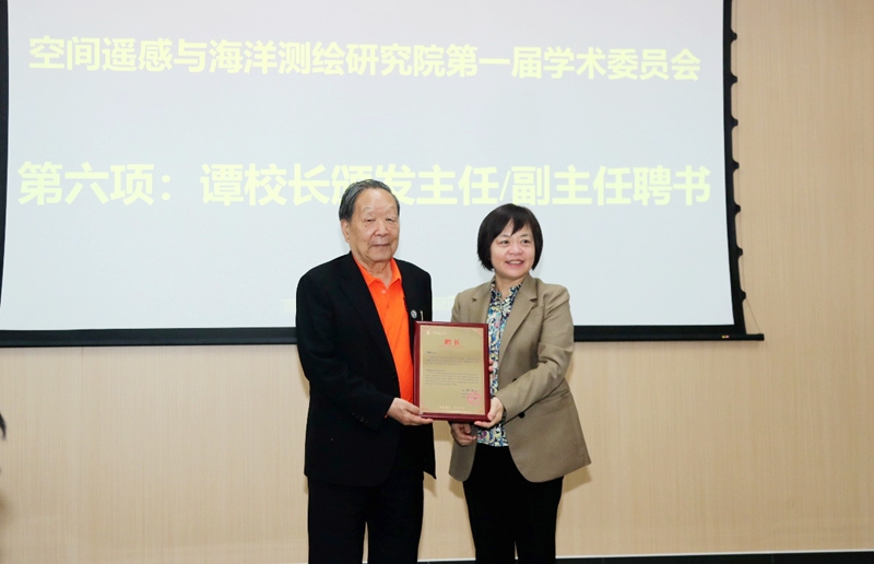
Tan Yiqiu presented an appointment letter to Academician Li Deren, the first director of the Academic Committee of the Institute of Space Remote Sensing and Marine Mapping.
At the academic conference held on the same day, Academician Li Deren delivered an academic report entitled "Spatiotemporal Intelligence Assisting Sustainable Development Goals," systematically explaining the theoretical connotation of spatiotemporal intelligence and its key role in the integrated "communication-navigation-remote sensing" satellite internet, and exploring the technological path of sky-ground-sea collaboration and its strategic significance for achieving global sustainable development. Academician Wang Jiayao, in his report entitled "The Creative Inheritance and Innovative Development Path of my country's Geographic Information System," reviewed the evolution of my country's geographic information system, analyzed the innovative directions and development paths of geographic information systems under the background of spatiotemporal big data, and proposed specific suggestions for promoting the national strategy of deep integration of geographic information technology.
Nearly 200 faculty and students participated in in-depth exchanges and lively discussions on issues such as spatiotemporal intelligent applications, future trends of geographic information system technology, and their synergistic development with national strategies.